
 Northern Illinois/Southern Wisconsin is on the edge of the heat!
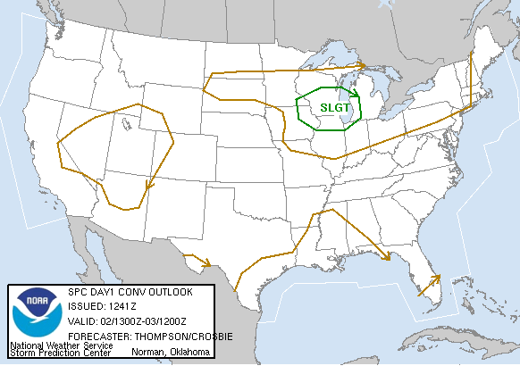
Often times we call this placement the "ring of fire." A frontal boundary will sag into Southern Wisconsin today providing the threat of severe weather. In fact, the Storm Prediction Center has placed a bullseye over us with a "Slight Risk." For more information on that, click on http://www.spc.noaa.gov for more.
What's even more impressive is the fact that we're in a slight risk for severe on Tuesday as well!
We'll be watching the radars closely during the next few afternoons/evenings. Large hail and damaging winds will be the main severe weather threats today and tonight. With the frontal boundary closer and enough upper level support, a small risk of tornadoes will also be present.
It's severe weather season. Hold onto your hats!


No comments:
Post a Comment