
 As temperatures on Monday will surge near 70° for much of the Midwest, a powerful cold front looms to our northwest.
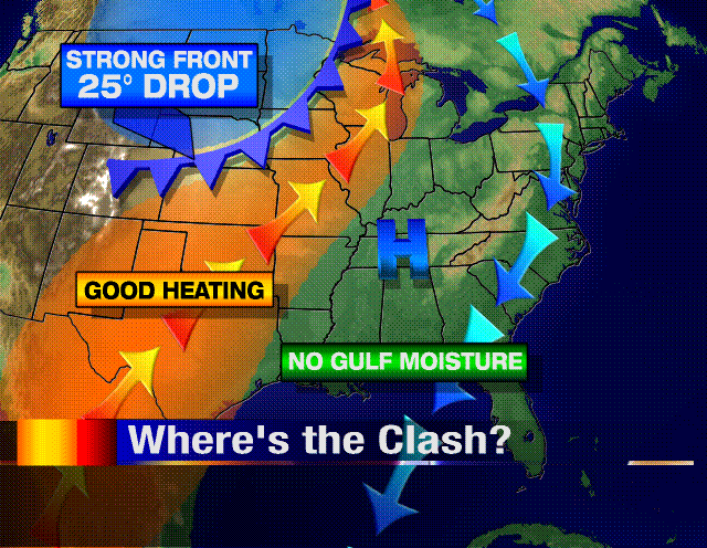
One thing is different between this cold front and many spring-time fronts. For one, during the spring time, cold fronts don't usually make it far enough south to stop the moisture flow off the Gulf of Mexico. A cold front did just that on Friday...one that was strong enough to produce a damaging tornado in the panhandle of Florida. Over the weekend, high pressure over middle Tennessee will allow dry, southwest winds to heat us up before our strong front arrives late Monday night.
This type of frontal passage is typical for October/November in the Upper Midwest. Because we're in such a progressive weather pattern, systems are too quick to move through before the atmosphere can charge itself up. Severe weather is not possible with the front Monday night...and with such dry low-mid levels of the atmosphere, I'll keep rain chances out as well! -ERIC


No comments:
Post a Comment