
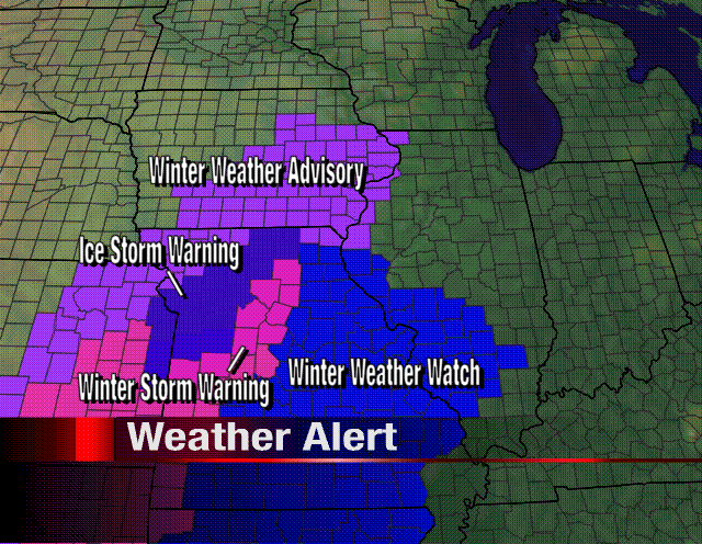
 As the very dynamic storm system continues to take shape in the southwest, Weather Advisories are already being issued for parts of Illinois, Iowa, and Missouri for tonight and tomorrow. As a cold front continues to move through Northern Illinois this morning, temperatures will fall throughout the day. But not before rain and even a couple rumbles of thunder move through. As lows tonight fall below freezing, rain will likely change over to freezing rain; starting in Iowa and moving east into Illinois. Already Winter Weather Advisories have been issued for parts of Iowa and Jo Daviess County in Northwest Illinois. Roads could be slick on Thursday. As temperatures struggle to make it out of the 30s for Thursday, snow and sleet will be likely early and then snow showers for the afternoon.
With the latest run of computer models last night, I'm not 100% convinced that we won't see any snow on Friday. While it looks like the major accumulations will remain south and east (things could get very interesting for Chicago and Indiana) we may end up with a couple of inches, with some areas receiving heavier amounts . However, the further west you go the chances of seeing snow will become less likely. The one very interesting thing with this system is that before anyone sees any winter precipitation, parts of Missouri and southern Illinois have the potential for some strong thunderstorms later today! Talk about a weather roller coaster ride!
If you have any travel plans be sure to check back for the latest weather updates!


No comments:
Post a Comment