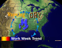
 High pressure will reside to our south for the majority of the work week and this will give us a drier and warmer weather pattern. The northerly winds ahead of the high will shut off the pipeline of moist air from the Gulf of Mexico. Therefore, any storms that try to swing through in the near future will have no fuel to generate much in the way of precipitation. The southerly winds on the backside of the high will gradually bring in some warmer air from the southwestern corner of the country.
In summary, for the next four days we should see just a few flurries on Tuesday with highs climbing into the 40s by the end of the work week.


No comments:
Post a Comment