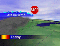
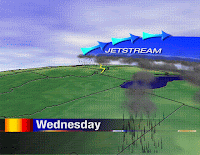
Even the most veteran Meteorologist will tell you that weather forecasting is complicated. I have fifteen years of experience and I still haven't figured out half of why the atmosphere works (and don't expect to in my lifetime). The majority of our weathercasts are consumed by temperatures, dewpoints, winds, and fronts; all of which happen right at the surface of the earth. However, to put together an accurate forecast you must always look up! For instance, today's weather was dominated by a section of jetstream that was slowing down. Meteorologists call this an "exit region." Usually we see pretty tranquil weather under an exit region and this was the case today. But by tomorrow we'll be under an "entrance region" of the jetstream. This will act like a vacuum cleaner high in the sky. Clouds will be allowed to grow tall; the tallest of which will produce thunderstorms.

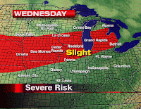
The Storm Prediction Center has a severe weather potential out for parts of the Missouri Valley tonight. A few of these storms will be near the Mississippi River by midnight and then into our area for Wednesday. Severe weather will be possible here with a tiny chance in the morning...and a more organized batch of big storms for Wednesday afternoon and evening. -ERIC

 Even the most veteran Meteorologist will tell you that weather forecasting is complicated. I have fifteen years of experience and I still haven't figured out half of why the atmosphere works (and don't expect to in my lifetime). The majority of our weathercasts are consumed by temperatures, dewpoints, winds, and fronts; all of which happen right at the surface of the earth. However, to put together an accurate forecast you must always look up! For instance, today's weather was dominated by a section of jetstream that was slowing down. Meteorologists call this an "exit region." Usually we see pretty tranquil weather under an exit region and this was the case today. But by tomorrow we'll be under an "entrance region" of the jetstream. This will act like a vacuum cleaner high in the sky. Clouds will be allowed to grow tall; the tallest of which will produce thunderstorms.
 The Storm Prediction Center has a severe weather potential out for parts of the Missouri Valley tonight. A few of these storms will be near the Mississippi River by midnight and then into our area for Wednesday. Severe weather will be possible here with a tiny chance in the morning...and a more organized batch of big storms for Wednesday afternoon and evening. -ERIC


2 comments:
yay. And the blog will get better i hope, right?
Yes, we were given real estate on wrex.com. We'll send out the housewarming invitations soon! -ERIC
Post a Comment