
 A major early-season winter weathermaker will develop over the next 48 hours. Severe weather across Arizona, New Mexico, and far west Texas was the beginning on Monday.
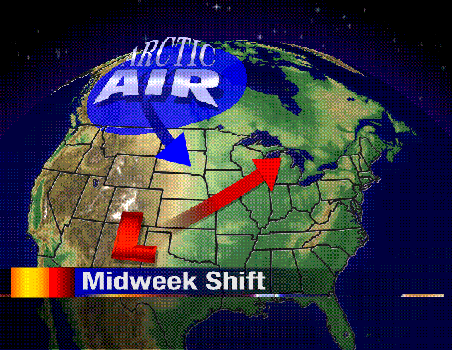
Low pressure will intensify as it rapidly moves into lower Michigan on Wednesday. This low will "bomb" out (meaning pressures will drop significantly) tugging an immense supply of cold air from the Northwest Territories of Canada.
Rain will begin on
 Tuesday night. But as the cold air filters in during the day on Wednesday rain will mix with or change to snow. Light rain/snow mix is likely for Wednesday night into Thursday as temperatures plummet.
Snowfall accumulations will be highly unlikely. Granted if the calendar read January or February I'd have a few inches in the forecast. Still, enough snow could fall to reduce visibilities just a tad...and remind us that winter is only a little over two months away. -ERIC


No comments:
Post a Comment