
 2:30pm- Two of the computer models forecasters use to forecast weather are now giving us a snowier future! The GFS and ECMWF (European) computer models are very similar in developing an intense low pressure center over southern Missouri for Wednesday. The system tracks to the northeast towards Detroit, Michigan by Friday afternoon. With the initial front coming through Rockford Wednesday evening, we'll see rapidly falling temperatures. With below freezing temperatures expected Thursday into Friday, this system will definitely be cold enough for snow. Right now we've got to decide whether we want to place our bets on the GFS and ECMWF. If you've ever been to Vegas, you know that you shouldn't put all your chips on one square. I've never
 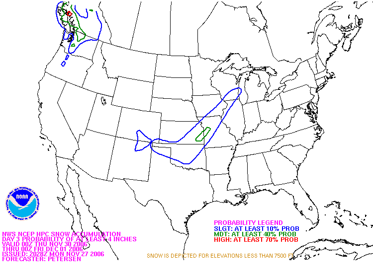 been, but I'm not about to go hogwild snowy for Thursday night.
The Hydrometeorological Prediction Center forecasts for winter events. Notice the blue outline. That is at least a 10% chance of a 4"+ snowfall.
5:58pm- The midday GFS model is out with a bullseye of precip over Northern Illinois. The liquid precip forecast for this event is progged at 0.79". In a perfect world, this would yield "many inches." -ERIC
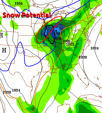 9:30pm- Evening computer models coming in now. The NAM computer model now points toward a snowy Friday. In fact, the NAM is giving us 1.24" of liquid precip. If this all fell as snow, it would be more 5". The track is crucial here, as the NAM is tracking the low about 50 miles east of the other models. This would put the heaviest snowfall east of the Rockford metro.
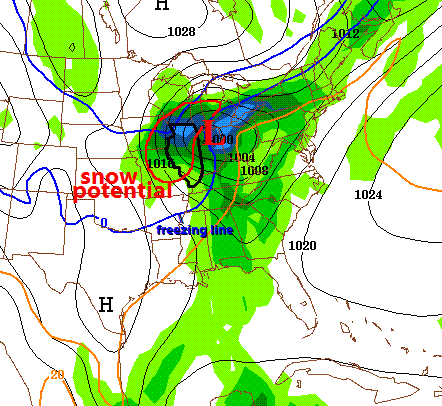
10:15pm- I've posted the new evening GFS model (to the left). Analyzing this new model run with the previous one (above) gives us an idea of how this will materialize. A few things stand out initially. First, the system is in a consistent track from Memphis to Indianapolis. What's interesting is the freezing line (blue line). It's trying to bring a little warmer air into the core of the system. This may actually increase the available moisture just a little bit. We're still firmly in the cold side (below 32°) so snow looks rather likely. We've still got to watch how the models track this...it is still subject to change. But it still looks really impressive! -ERIC


3 comments:
thanks eric! I love snow!
i do not want snow just yet
More models are coming in line tonight! Consistency will be a big thing here. If we can get the models to have the same result each day, they'll be more believable. -ERIC
Post a Comment