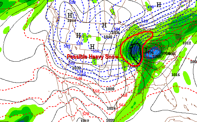
 Here is a glimpse of the noon Tuesday GFS computer model's interpretation of Sunday night's weather. As we've discussed in past blog-posts, it's a "thickness" map showing the relative thickness of the atmosphere. Generally to receive snowfall, we need thickness values to be below 540. In this case, the precipitation will be all snow. The amounts may be heavy (especially over Central Illinois). Keep in mind, the track will wobble back and forth...north...then south again. We'll keep tabs on all of the models right here on the weather blog. Have a great night and stay tuned! -ERIC

Tuesday, January 09, 2007
Illinois Snow Late Sunday???
Here is a glimpse of the noon Tuesday GFS computer model's interpretation of Sunday night's weather. As we've discussed in past blog-posts, it's a "thickness" map showing the relative thickness of the atmosphere. Generally to receive snowfall, we need thickness values to be below 540. In this case, the precipitation will be all snow. The amounts may be heavy (especially over Central Illinois). Keep in mind, the track will wobble back and forth...north...then south again. We'll keep tabs on all of the models right here on the weather blog. Have a great night and stay tuned! -ERIC
Subscribe to:
Post Comments (Atom)


No comments:
Post a Comment