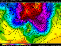
 Here are two images from Thursday's European computer weather model run. The first image shows the temperatures on Friday morning. (Note they are plotted as "850mb temperatures." 850 millibars basically corresponds to the level of the atmosphere about 5,000 feet up. This is where we look to see where cold and warm air
  move.) No doubt about it, Friday morning starts on a very warm note! You can see we're about +5°C (or 41°F) during the morning. However, the second image shows the temperature on Wednesday morning. Notice we've dropped to -12°C (or 10.5°F). While I don't think we'll be that cold, it will certainly feel more like winter next week.
Aside from the cold, a few week clipper systems may provide some very light precip...nothing to get too excited about. -ERIC


No comments:
Post a Comment